Well, it appears that the Annual Day Zero PCT Kick-Off event has been cancelled for 2016 because of bureaucratic issues with San Diego County Parks, leaving me with no clear date for my Celebrate Anza event, which has traditionally* followed ADZPCTKO by a week — just about the time that the bulk of the thru hikers who start from the border for ADZPCTKO have hiked 145 miles to my place. What to do? With the heavy snow pack in the Sierra, should I assume thru hikers will be starting later than in the past couple years? With the (already) hot temperatures in SoCal, should I hold the event at its usual time (the first weekend in May), or even earlier, on the theory that hikers will be starting earlier than usual? I’ve already met a few thru hikers who started very early (but were planning on taking time off before hitting the Sierra). Stay tuned.
* “Traditionally” is a bit of a stretch, considering that 2016 will only be the third Celebrate Anza I have hosted for thru hikers on my property.
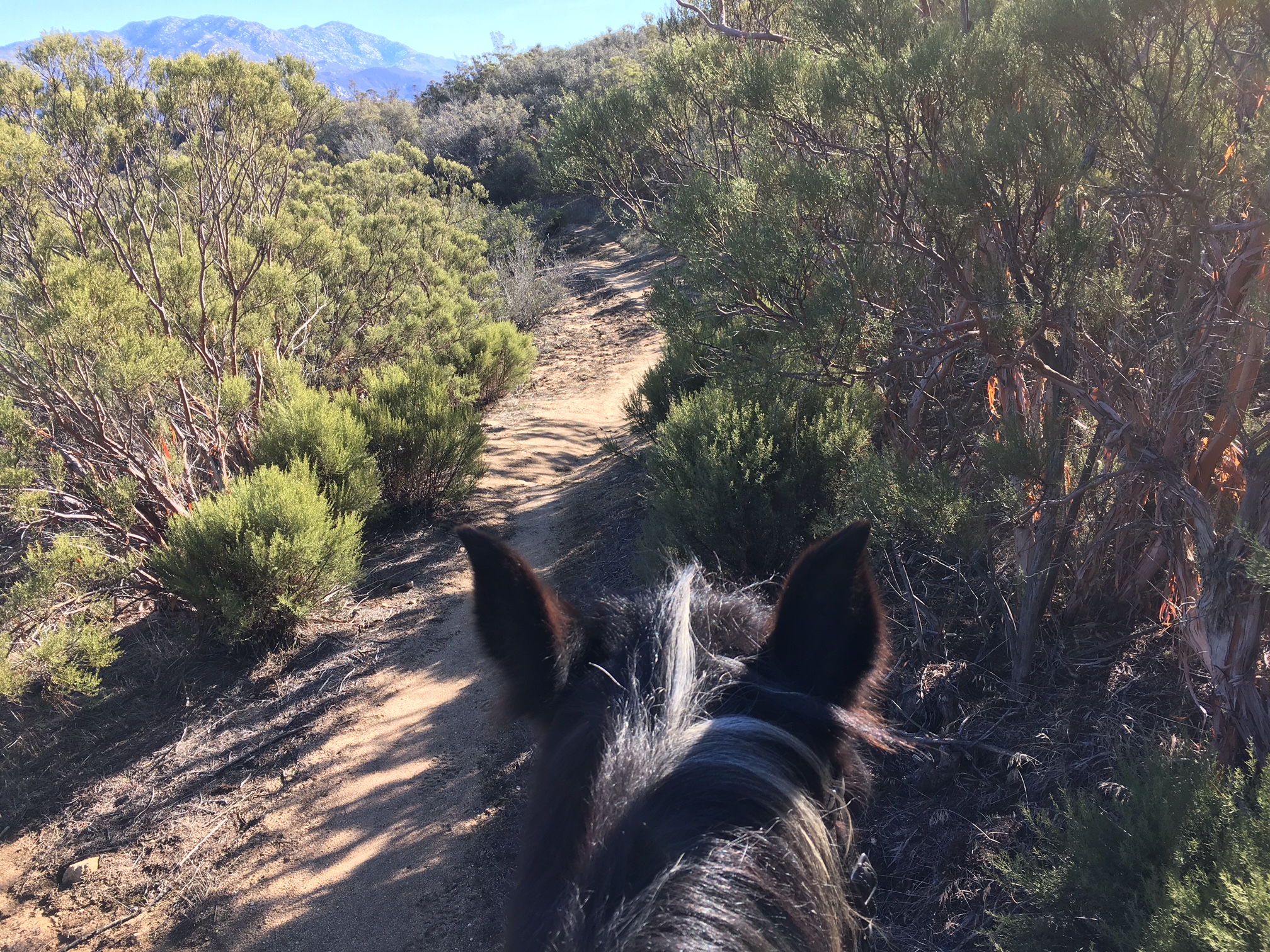
The weather over the MLK holiday weekend in Anza was ideal for riding, so Gracie and I headed north on the PCT. Got this shot of Santa Rosa and Toro Peaks in the background from the PCT just north of the second Table Mountain Truck Trail crossing.
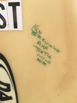
This weekend saw two more signatures on my surf board “trail register”. (Eventually, the novelty of my trail register will wear off, but for now, I check it every day to check that the markers are there, etc.) I met Ken (aka, “Turtle”) on the trail north of my place as I was returning from a ride.
Saturday I hiked from my place PCT north to Highway 74. Sunday I decided to continue my reconnoiter south from my place to Coyote Canyon Road. Because the precipitation on this portion of the trail, which is lower in elevation and south facing, likely fell as rain, the chance of trail erosion from the 3+ inches of rain that fell that week was much higher. Plus, there is a nasty boulder that has been looming over the trail for years on the north slope of Nance Canyon, always threatening to let loose at the next big rain, and I wanted to check that it had not fallen and taken a portion of trail with it.
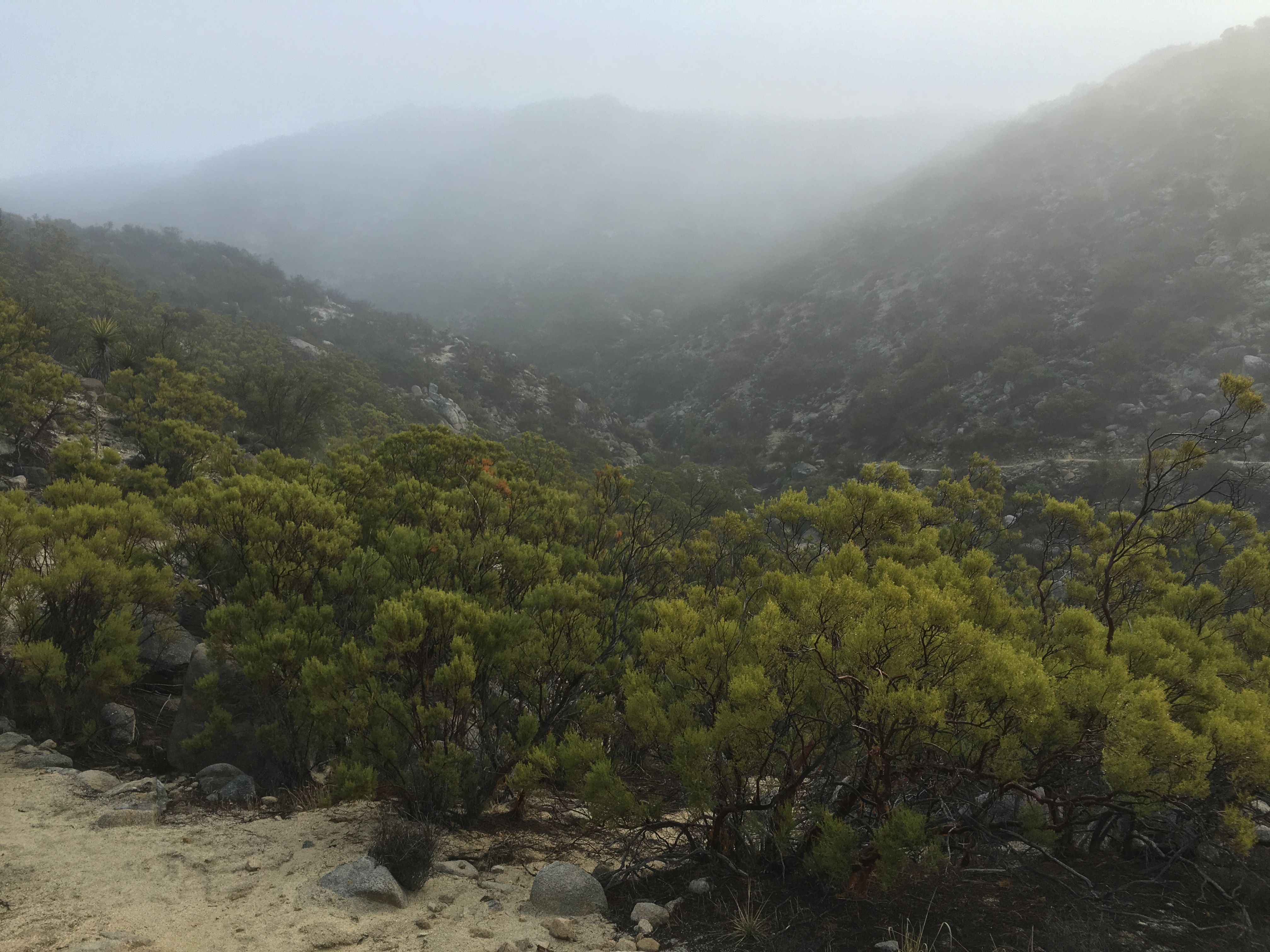
I left just as a heavy fog was lifting. I got a nice shot of an unnamed side canyon on Table Mountain (mile 144.3) with some fog still clinging to the mountainside.
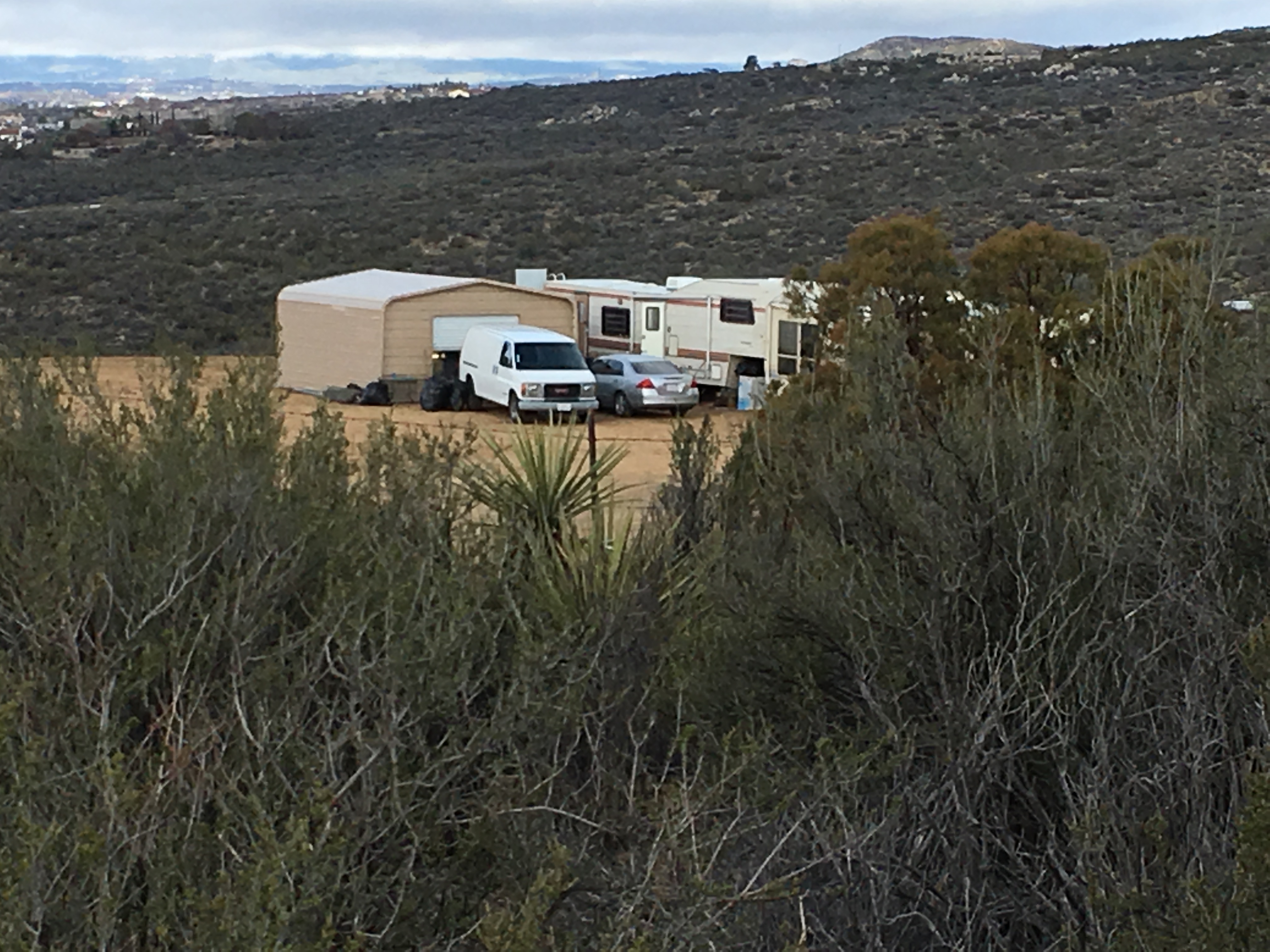
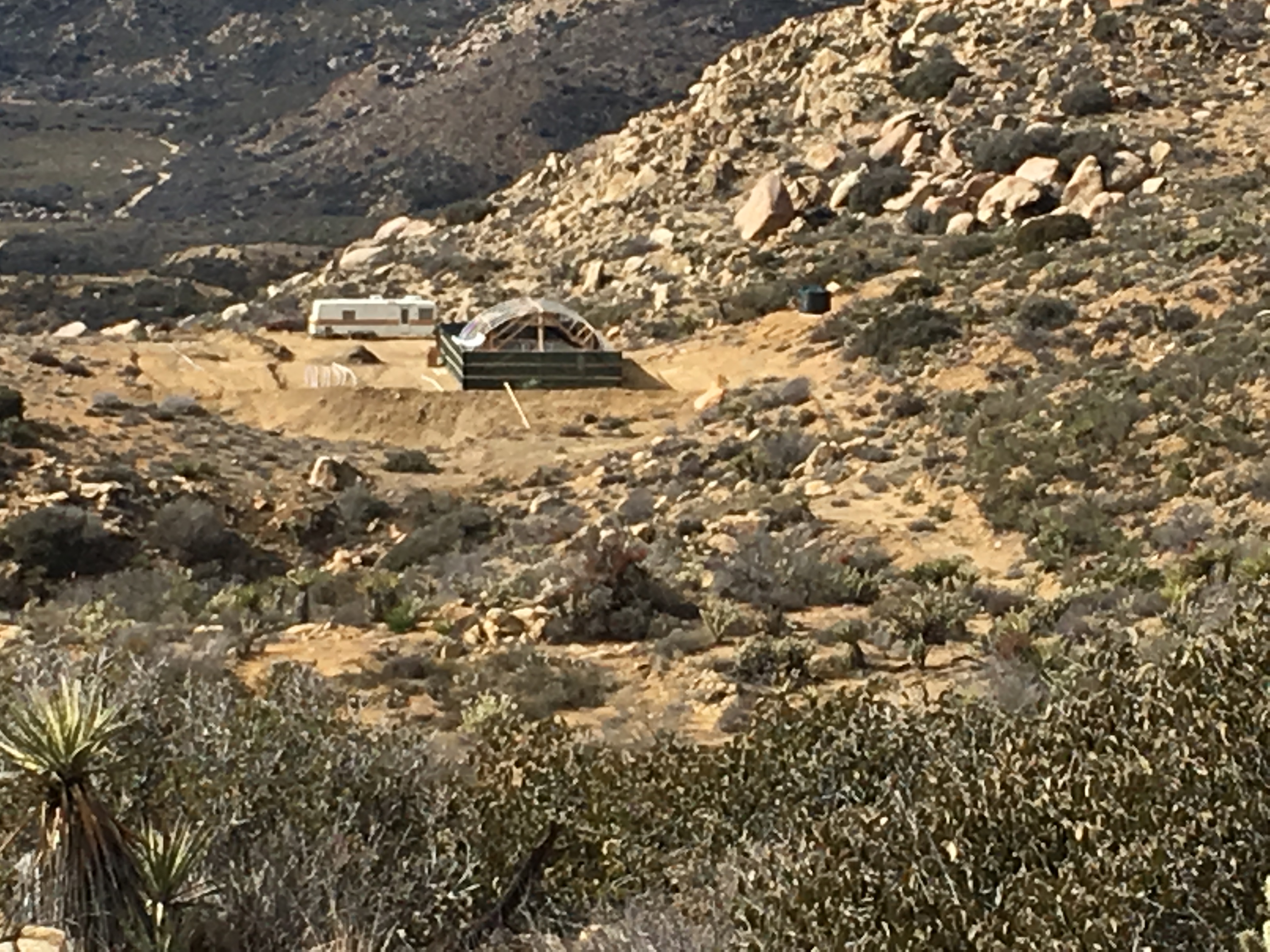
The 3 mile portion of the PCT south of my place has been taken over by large-scale pot growers and every time I walk this way, a new one has popped up (or a new grow house has appeared). The following pictures were all taken from the PCT with my iPhone. (All can be clicked on to view detail.)
FYI – If you are a hiker or equestrian passing through this area, the people at these pot farms are not nice. Stay on the trail and do not (DO NOT!) attempt to go and see what they are up to.
Once past all this nastiness, I had a lovely hike down into Nance Canyon. I was hoping that, with all the rain, Nance Creek would be flowing (as it has done reliably through the spring until two years ago), but, alas, it was dry. The picture on the left shows where the PCT crosses over the “creek”, now better named a dry wash.
The north-facing side of Nance Canyon has several boulders with beautiful displays of multi-colored lichens. Here is an example:
Click to enlarge to see detail of individual lichens
So many people pass through looking only for the vistas — the views on a grand scale — and the miss the beauty under their boot soles.
I hiked out of Nance Canyon to Coyote Canyon Road to check that the guard posts preventing ATV access were still in place. — Everything looked good, so I reversed my tracks and headed home.
The only damage from the recent rains was a very small landslide on the south face of Nancy Canyon. I pushed and kicked the fallen rocks off the down side of the trail in a matter of minutes and was on my way.
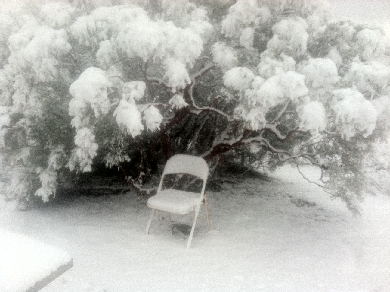
With our first El Nino storm of the 15-16 winter, I decided to spend Saturday checking trail conditions on the portion of the PCT from my place (mile 145.4) north to where the PCT crosses Highway 74 (mile). I assumed that most of the 3+ inches of precipitation that week had fallen in the form of rain, which meant possible landslides and/or erosion on the trail tread in “the usual” problematic spots that the Trail Gorillas need to patch every year.
The 2 miles up to the main ridge of Table Mountain was uneventful. — The trail was still a bit wet, but nothing significant. As soon as I hit the other (the north-facing) side of the ridge, I was surprised by 4 inches of snow. I’ve come to learn that the desert mountains are funny that way. — That side of Table Mountain remains permanently frozen from January through mid-March, even when just a quarter mile away (and at the same elevation) the south-facing slope is unfrozen — even balmy. Precipitation that fell as snow melts immediately because the ground is so much warmer.
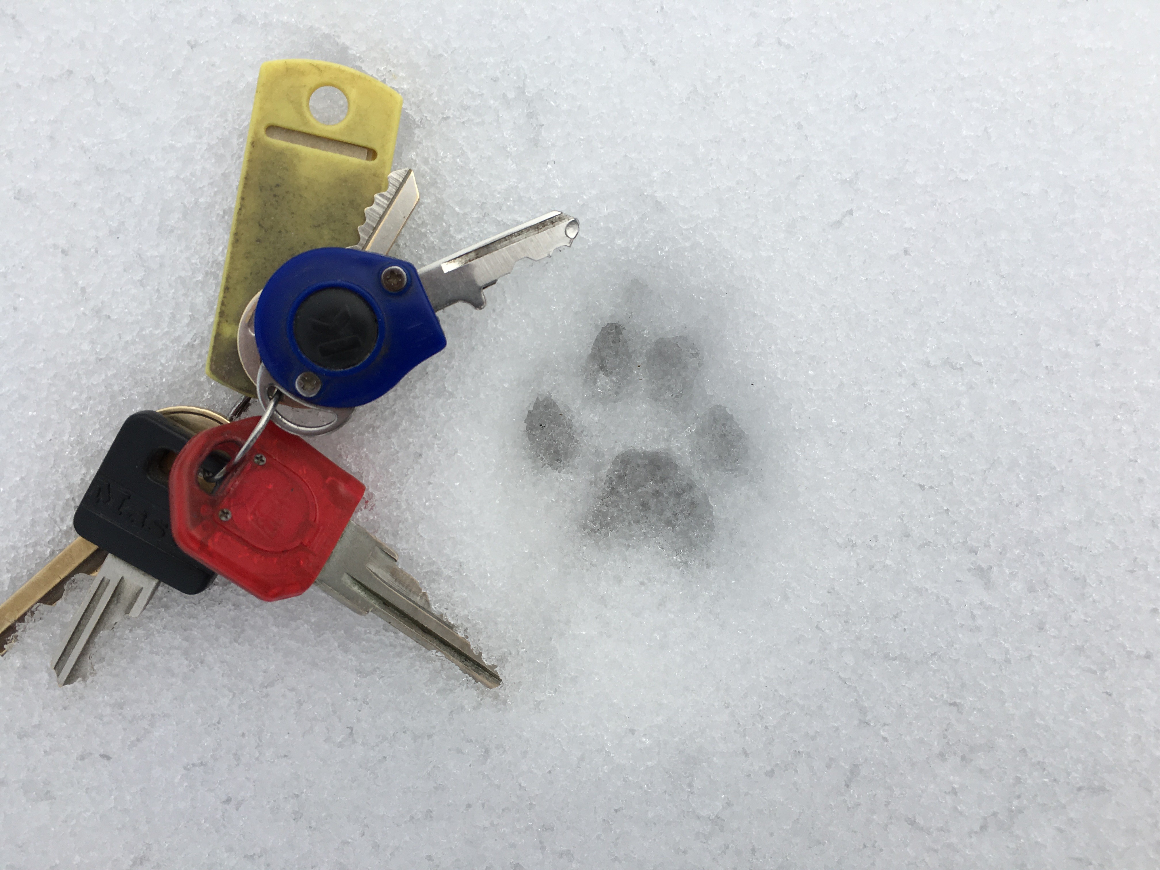
Snow on PCT at mile 150
I love being the first human to walk on snow, because the number of tracks show us that we are not alone. I followed this small canine — fox or small coyote — whose paw print is captured in the photo for over a mile on the trail that morning.
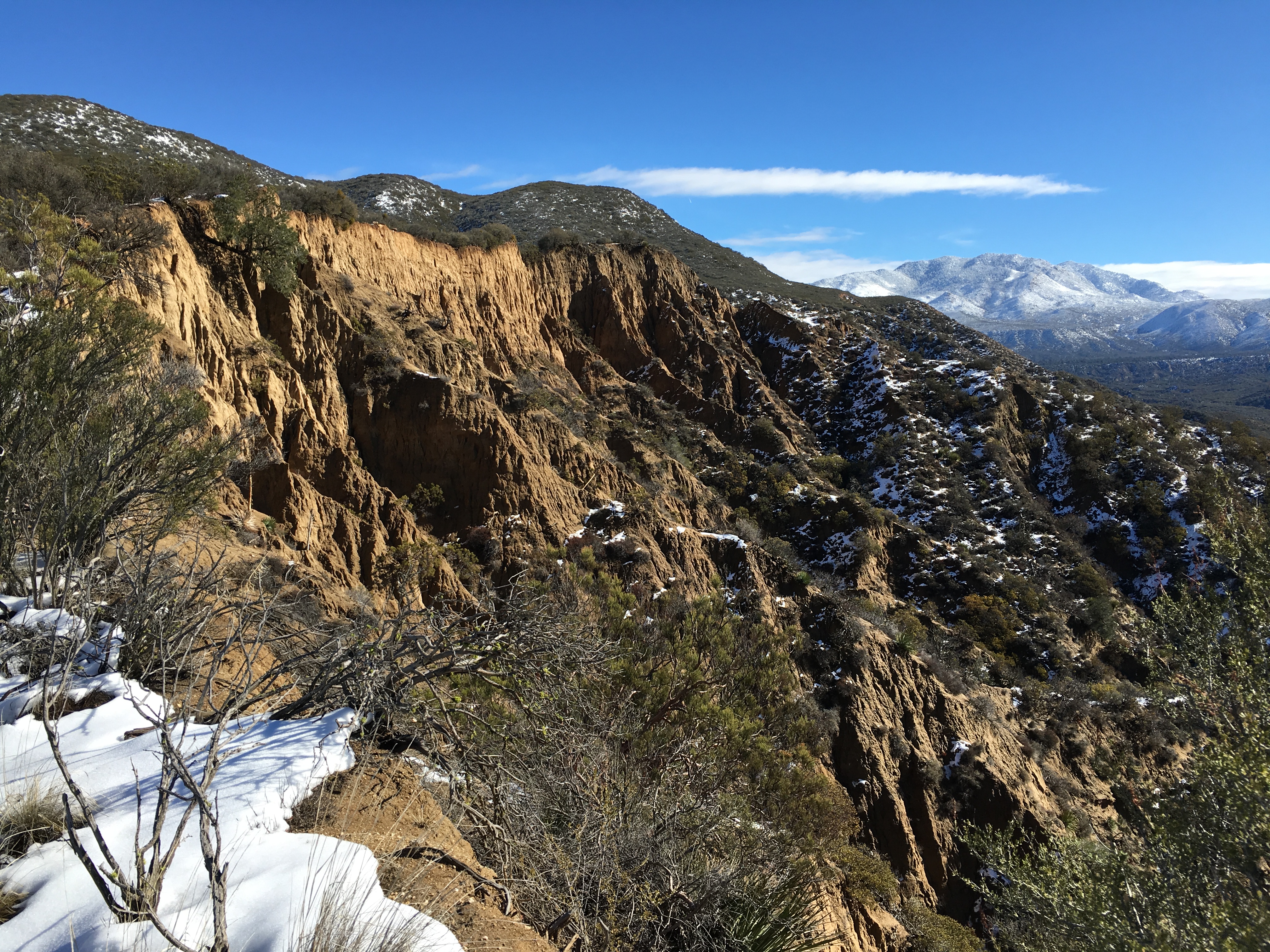
Eroding ridge of horse canyon with Toro and Santa Rosa peaks in background
One of my favorite places on this stretch of the PCT is this overlook of Horse Canyon that I affectionately call “Anza’s Grand Canyon” for its beautiful erosion patterns and steep, cliff-like sides.
I made it to Highway 74 only to find several cars with adults and kids pulled off at the PCT parking area engaged in a brutal snowball fight. I was thinking of walking to Paradise Valley Cafe for one of their famous Jose Burgers, but decided I needed to get home, so I headed back, retracing my steps.
Because the precipitation fell as snow, there was no damage to report on this section of the PCT to the Trail Chief for California Section B.
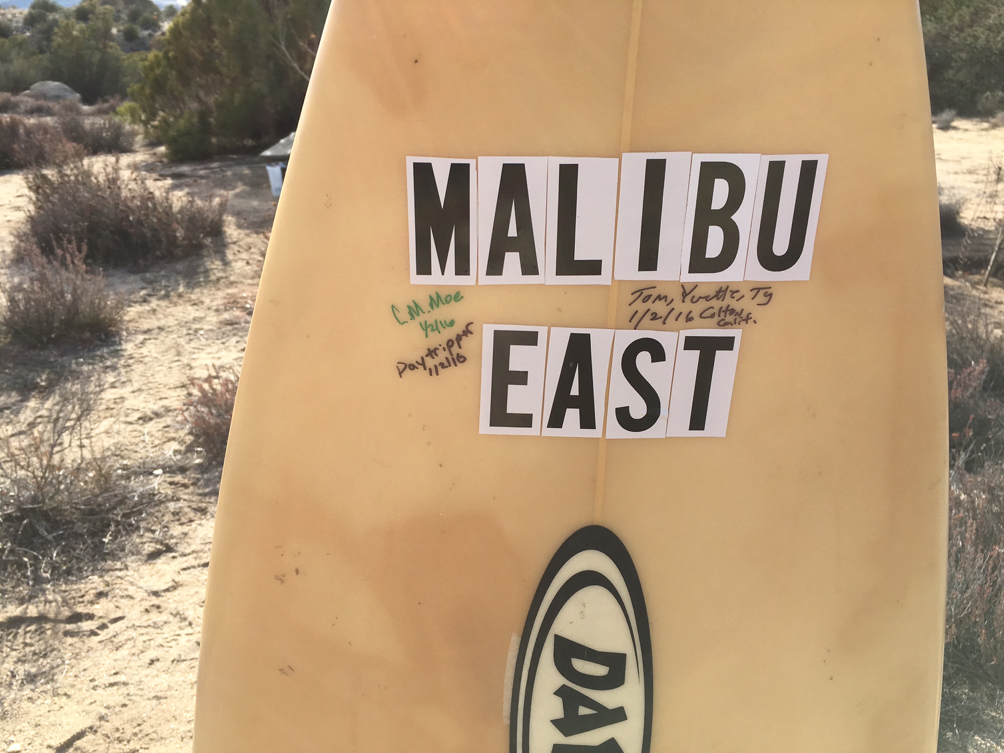
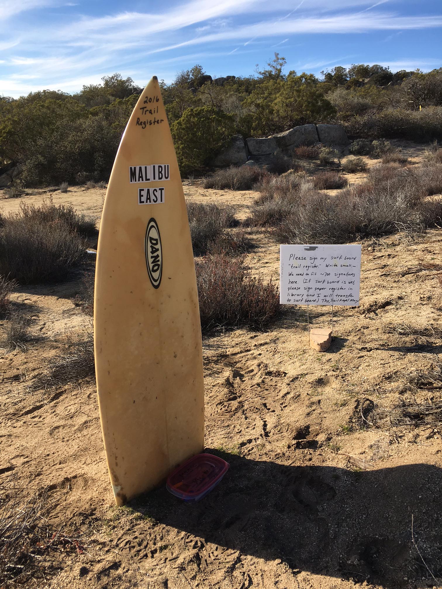
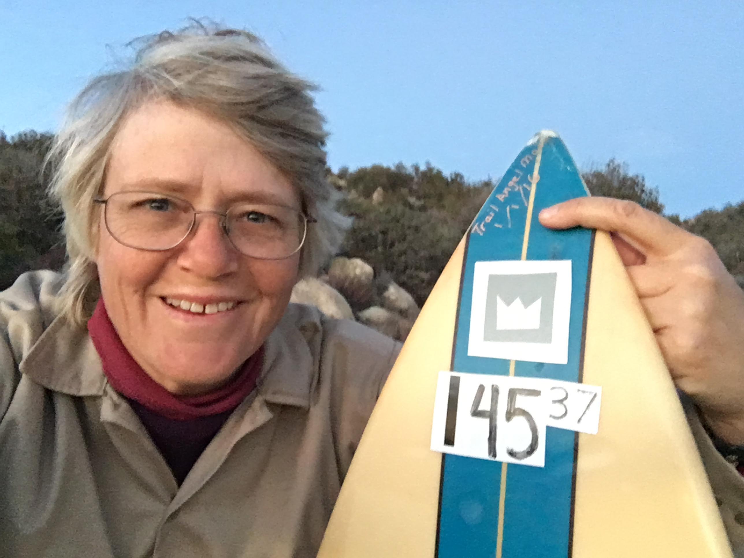
I had the bright idea of setting up a trail register for 2016 to get a better feel for the number of hikers visiting my place. Rather than have hikers sign a notebook, I thought this might be a good use for my surf board, which is holding up better than I expected in the sun, wind and snow of the desert mountains. I posted a sign with instructions for signing the register: “Please sign my surf board ‘trail register.’ Write small — we need to fit ~700 signatures here. (If surf board is wet, please sign paper register in library and I will transfer to surf board.) Thx, Trail Angel Mary”
I left a container with variously-colored permanent markers nearby, and let the experiment begin.
I was the first person to sign in the afternoon on January 1, 2016.
If you are looking for a particular name, I have gathered all the surfboard photos in a gallery on the right. Click on any one to cycle through the images.
With last week’s snow just a memory, I thought I’d spend this weekend prepping my hiker & equestrian rest stop for the winter. I removed the water tank I used for automatically watering the future shade tree and put a new coat of shellac on the picnic table. I also re-painted the front of my library, which had a lot of peeling paint. I brought my banjo with me, so that I could do a bit of playing after the work was done and shot this photo.
While I was practicing, my neighbor Carl rode up on his horse and we chatted a bit, then he rode off on the trail.
I noticed that two books that were very special to me, Thoreau’s Walden and Paz’s Labyrinth of Solitude had disappeared from the library. In their place was a guide to identifying trees in the Sierra Nevada.
We got our first snow in Anza on the day after Thanksgiving. It was falling when I woke up at 6am and continued to snow until about 9am. All told, we got ~2.5 inches a fairly wet snow. The sun came out in the afternoon and it was mostly gone, except on the north sides of hills, by the end of the day. I went out with my camera and got some nice shots of snow-covered redshank.
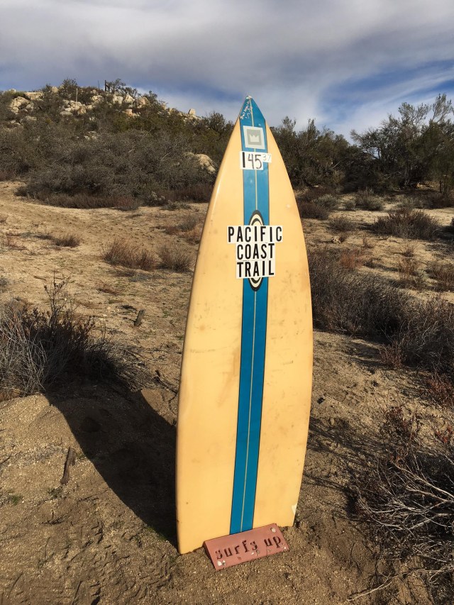
Last year, I had to contact the PCTA in the context of an article I was writing for my local Anza paper and stumbled across the page on their site providing information for the press. I was struck by the fact that they needed to correct people who thought PCT stood for Pacific COAST Trail, presumably because so many southern Californians get confused because the PCT (Pacific Crest Trail) sounds a lot like the PCH (Pacific Coast Highway).
Someone on my street was giving away a ratty old surf board, so I had an idea … a play on the mistake “Pacific Coast Trail.” You can see the results below. (I don’t know how long the surf board will last in the extreme sunlight and wide temperature swings typical of the desert mountains, but I’ll enjoy my little inside joke for as long as it does.)